SmartMountain™, a suite of web and mobile applications designed to collect, organize and share information vital to maintaining snow safety and improving ski patrol operations in ski areas.
Play Video
The geospatial software application provides easy organization for your ski patrol and mountain dispatch.
How Will SmartMountain Benefit You?
SmartMountain provides ski area operators the ability to overview their operations, the related incident documentation for their ski patrol, and a dispatch system for their mountain operations. Ski lifts status in real-time, geospatial incident tracking, all incidents time-stamped at origination, patroller roster management, and patrol activity tracking and all forms and procedures can be developed and managed in-house. SmartMountain creates transparency, clarity, and efficiency in operations and incident management.
One system for all equipment – mobile and desktop.
Dispatch dashboards formatted in-house.
All data for any incident collected in one place.
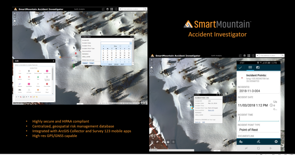
Accident Investigation tools.
Information is easily accessible and managed.
Excellent documentation.
Accident Investigation tools
Information is easily accessible and managed
Excellent documentation
"SmartMountain has been a reliable partner for tracking data for everything from avalanche paths to skier incidents. We love the ability to customize the programming to meet our operational needs, rather than having to adapt our operations to fit the software. In addition to supporting ski patrol needs, Smart Mountain has great applications for infrastructure planning and mapping, as well."
Drew Kneeland,
Ski Patrol Director,
Jackson Hole Mountain Resort
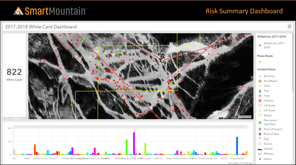
SmartMountain, developed by Earth Analytic, is scalable to your ski area, small or large. The information you will gain from Smart Mountain will allow you to make more informed decision and provide a clear assessment of risk. Whether it be skier incidents, avalanche mitigation, terrain assessment, patroller performance , on hill work assignments, Smart Mountain provides visual feedback as soon a something happens. You can visualize a day, a week, a group of days or a year of metrics as to when and where they have happened.
Data and Information
Database of record: Centralized and organized data assists in recognizing and evaluating patterns, resulting in more thoughtful planning and informed predictions.
Rapid, intuitive retrieval of current and historical data (accessible on or offsite) improves decision making at all levels of management.
Simple report generation.
Reduces risk and potential lawsuits.
Supports visualization of current and future mountain infrastructure (e.g. Gazex explosives locations, forest thinning, designing new runs, parking, etc.).
Please click on the images to learn more
Ski Patrol
Ease of real-time data entry (no more logbooks or spreadsheets!).
Use of common language allows for consistent communication and information sharing.
Increases safety by minimizing accidents through pattern analysis of incidents.
Accident Investigation and Risk Management.
Snow Safety (Ski Patrol) Training.
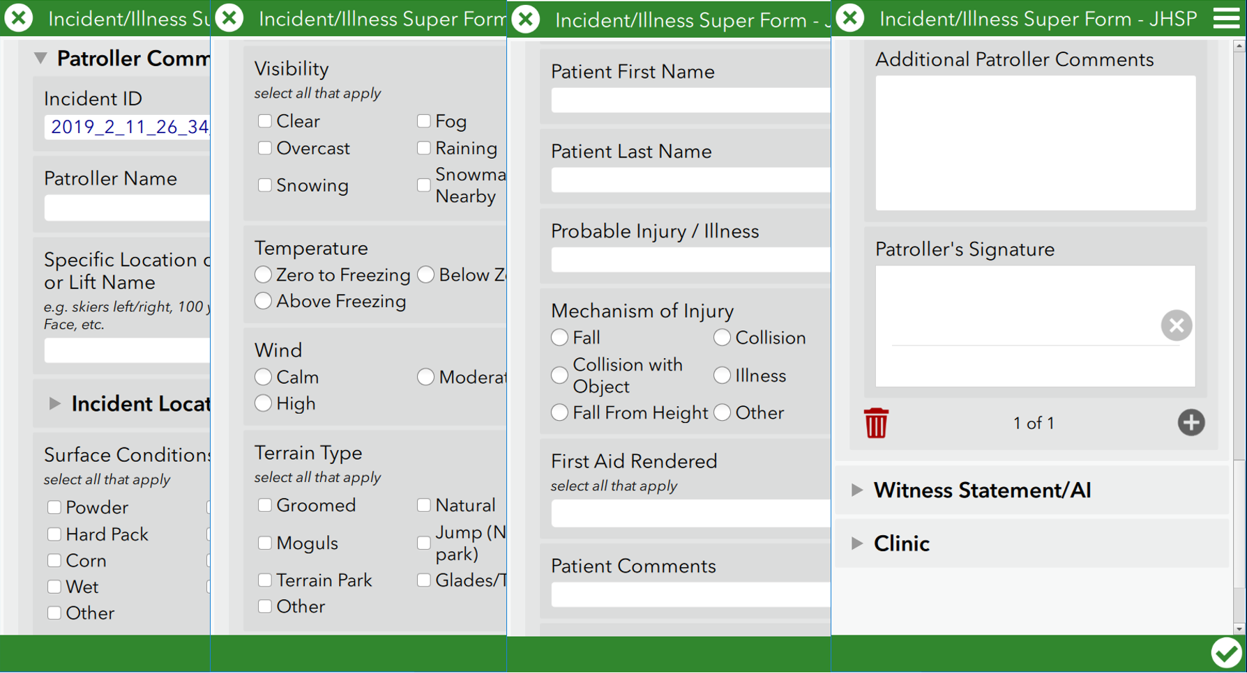
The web and mobile application suite will provide editing and data collection tools for mapping incidents (wrecks, accidents) of any kind.
Please click on the images to learn more.
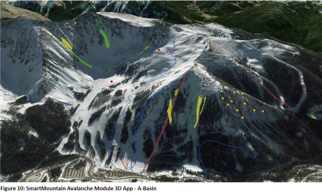
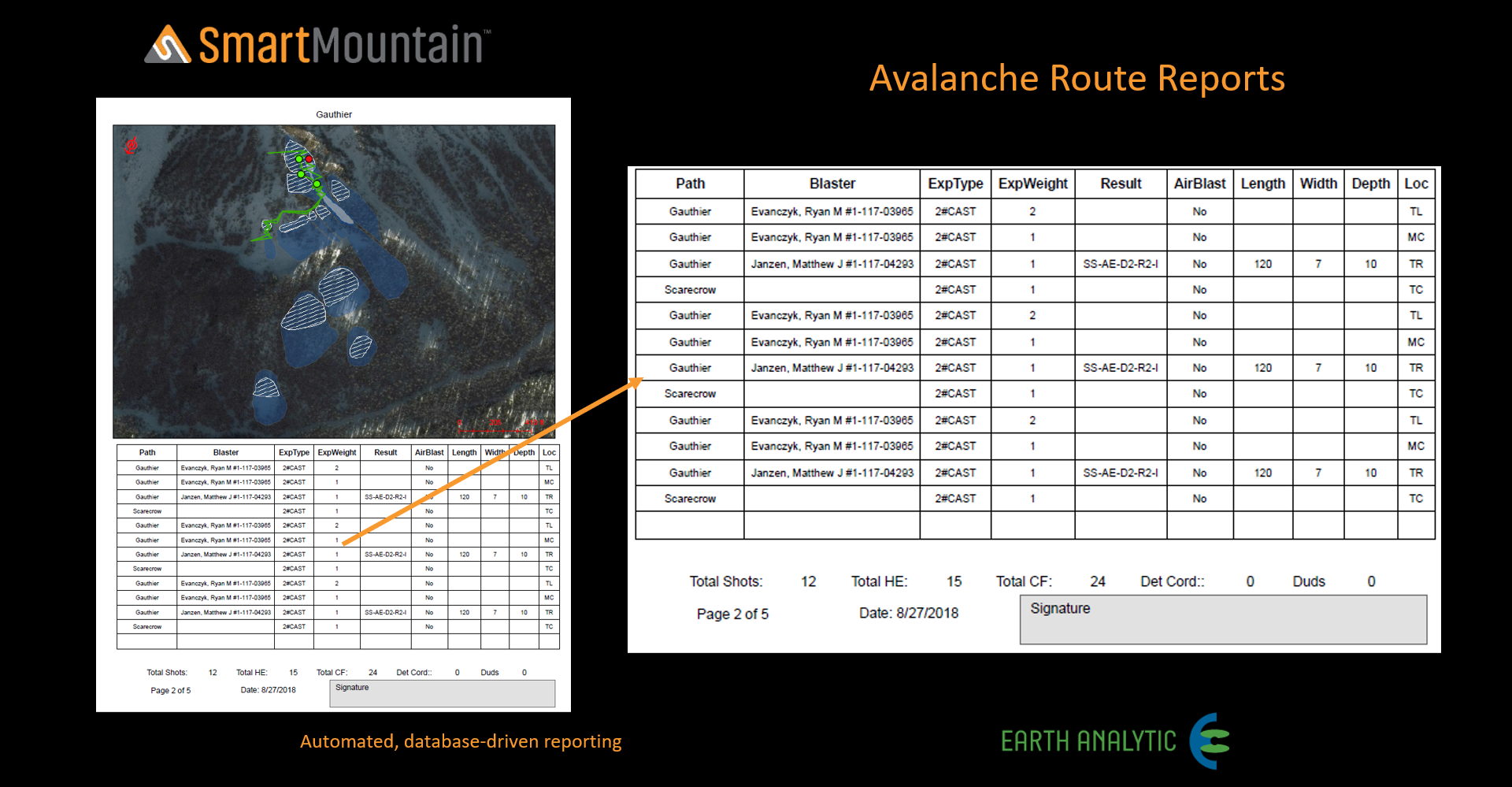
Avalanche Module
Ability to document, track and analyze slope conditions with one tool.
Ease of real-time data entry (no more logbooks or spreadsheets!).
Centralized and organized data assists in recognizing and evaluating patterns, resulting in more thoughtful planning and informed predictions.
Provides detailed current and historical weather patterns for visualizing/predicting.
Saves money through more precise use of explosives.
Please click on the images to learn more.
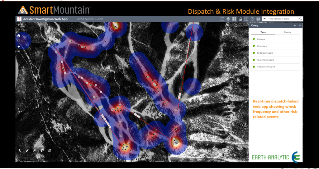
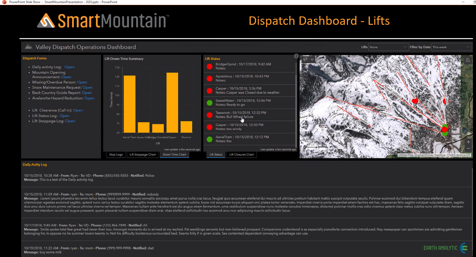
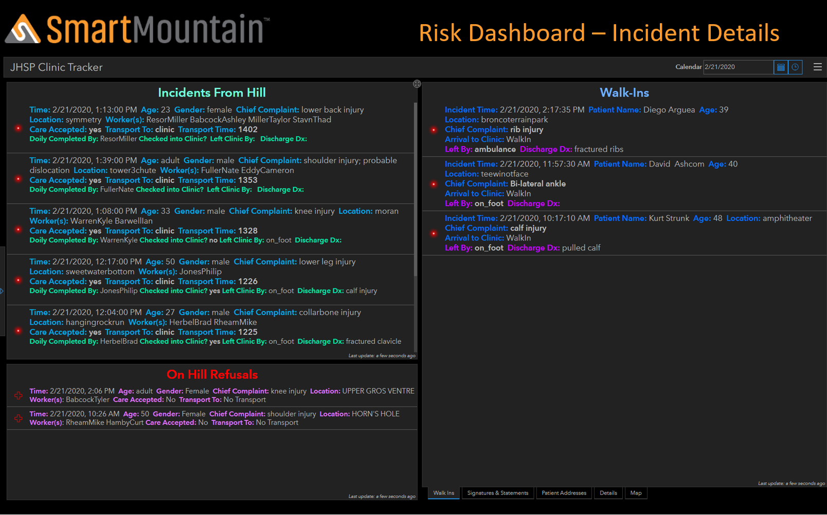
Dispatch
The dispatch and risk module leverage Esri’s Survey 123 for ArcGIS, providing an intuitive survey-form, data-driven workflow for point feature collection and reporting. Data collected with SmartMountain Survey apps, which are available for both web browsers and native desktop and mobile apps for standard operating systems, are integrated with one or more SmartMountain modules, providing real-time or disconnected and later synchronized workflows for data collection and integration.
Each ski resort decided what they wish to display on the Dispatch Dashboard including on-hill incidents, walk-in incidents, on-hill refusals, missing persons, work details for different departments, ski patrol rosters for the day, clearances, and sweeps.
Please click on the images to learn more.
OPERATIONS
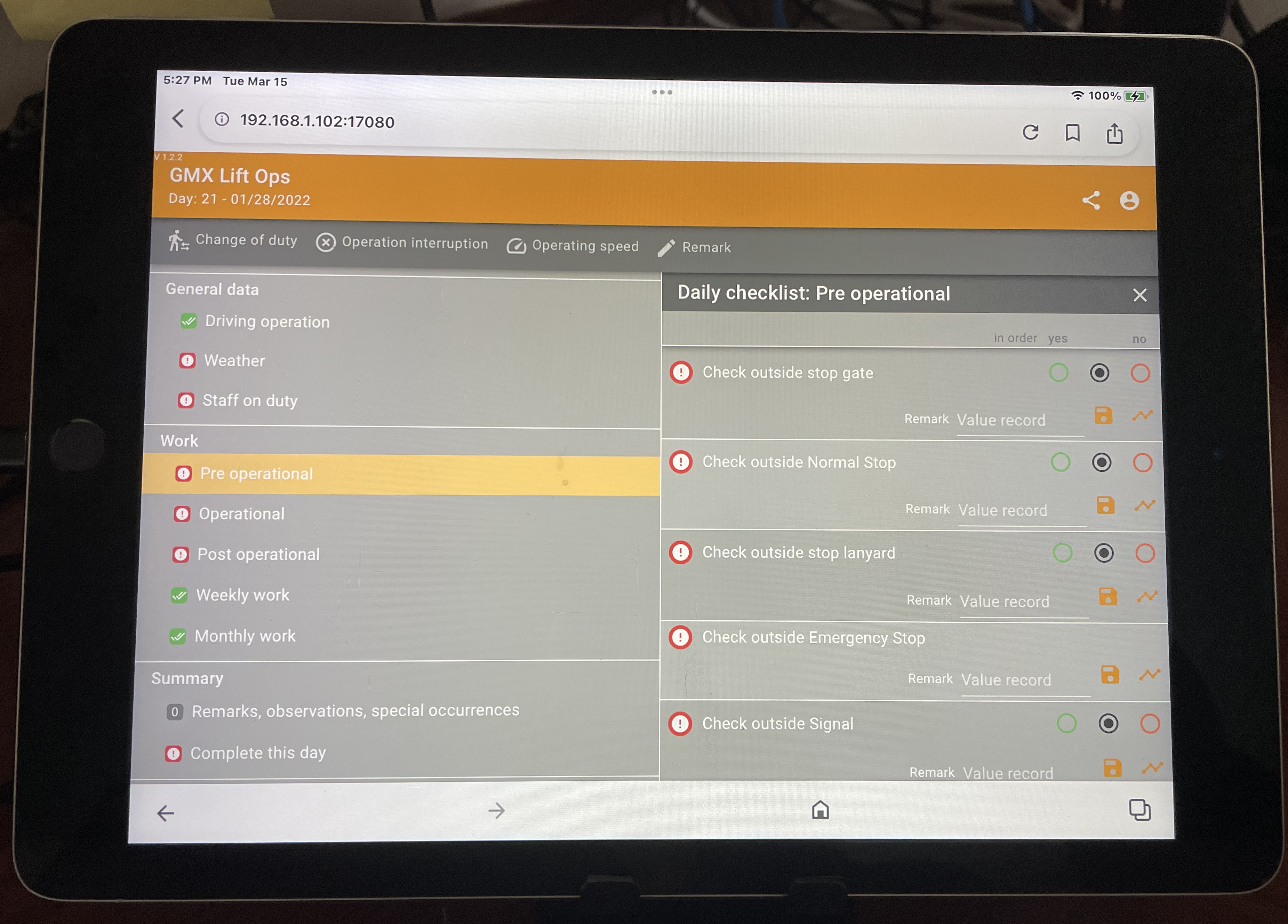
LOGBOOK
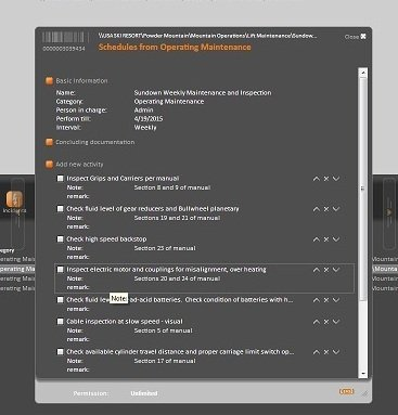
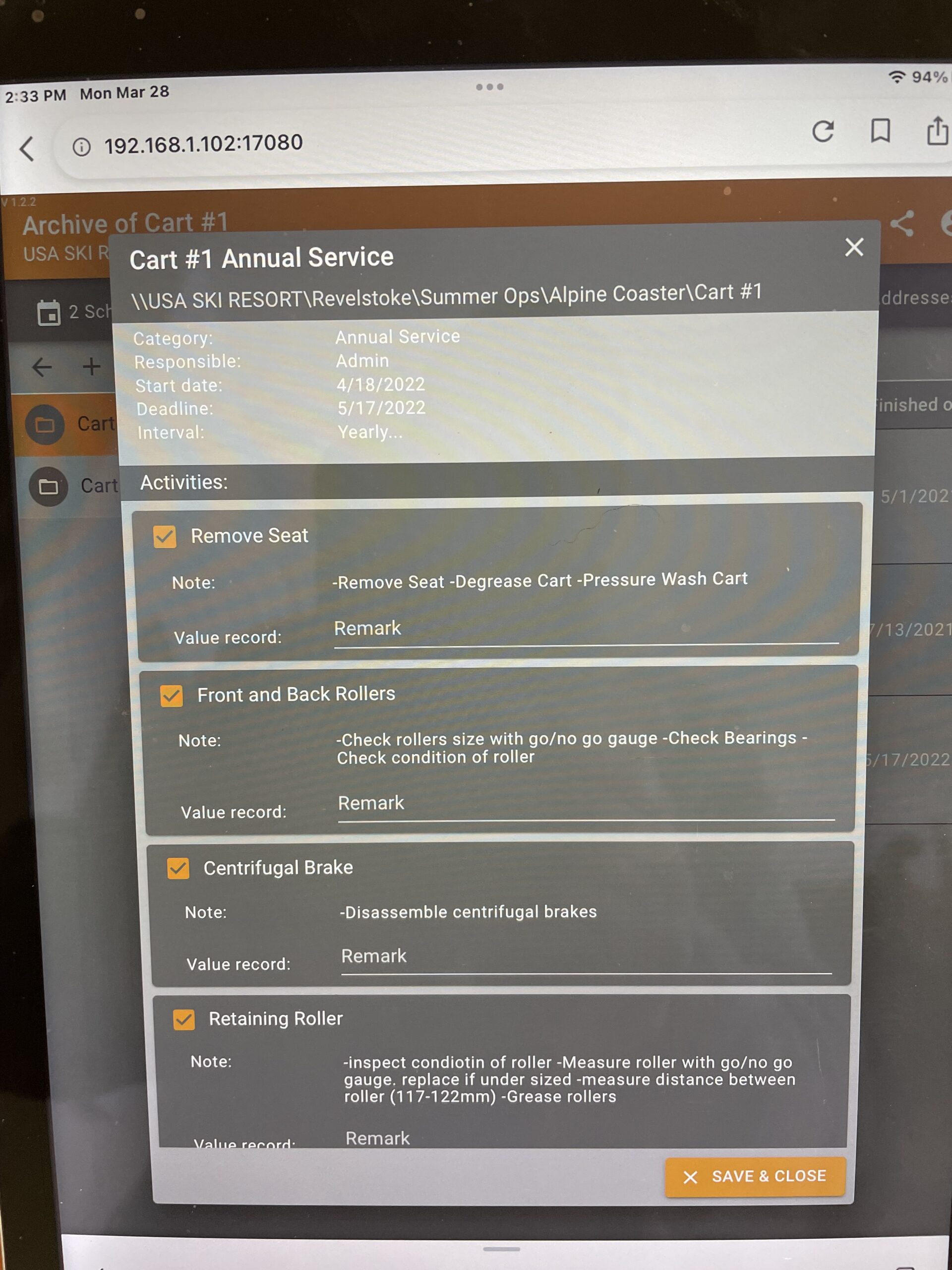
Logs for Lift Maintenance, Lift Operations, and Groomer inspections, as well as building inspections.
Logs can record data and signatures, can record stops, station assignments.
Logs are tracked by calendar.
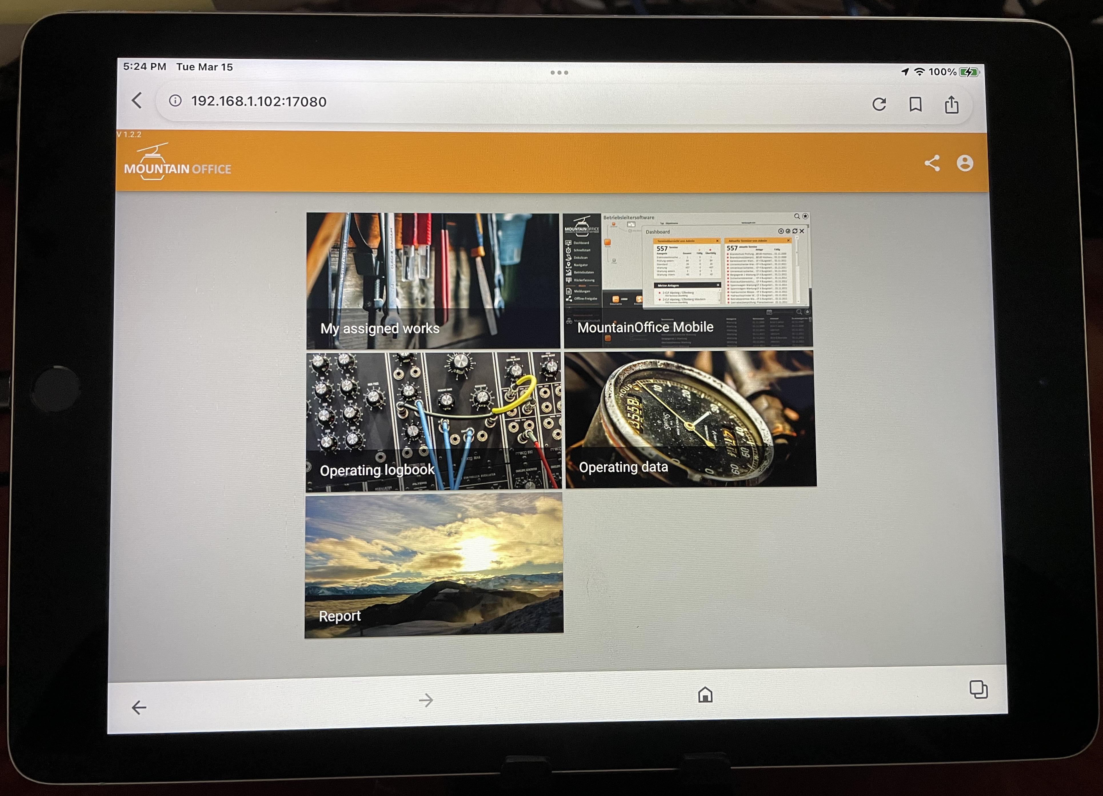
INFORMATION
Management review made easy through the use of Excel – reviewing a major grouping of assets or a single component of an asset such as a drive or a gearbox.
All information related to a system(asset) is in one place whether it be a lift inspection report, a manual, oil analysis, a service bulletin, or a letter from a vendor.
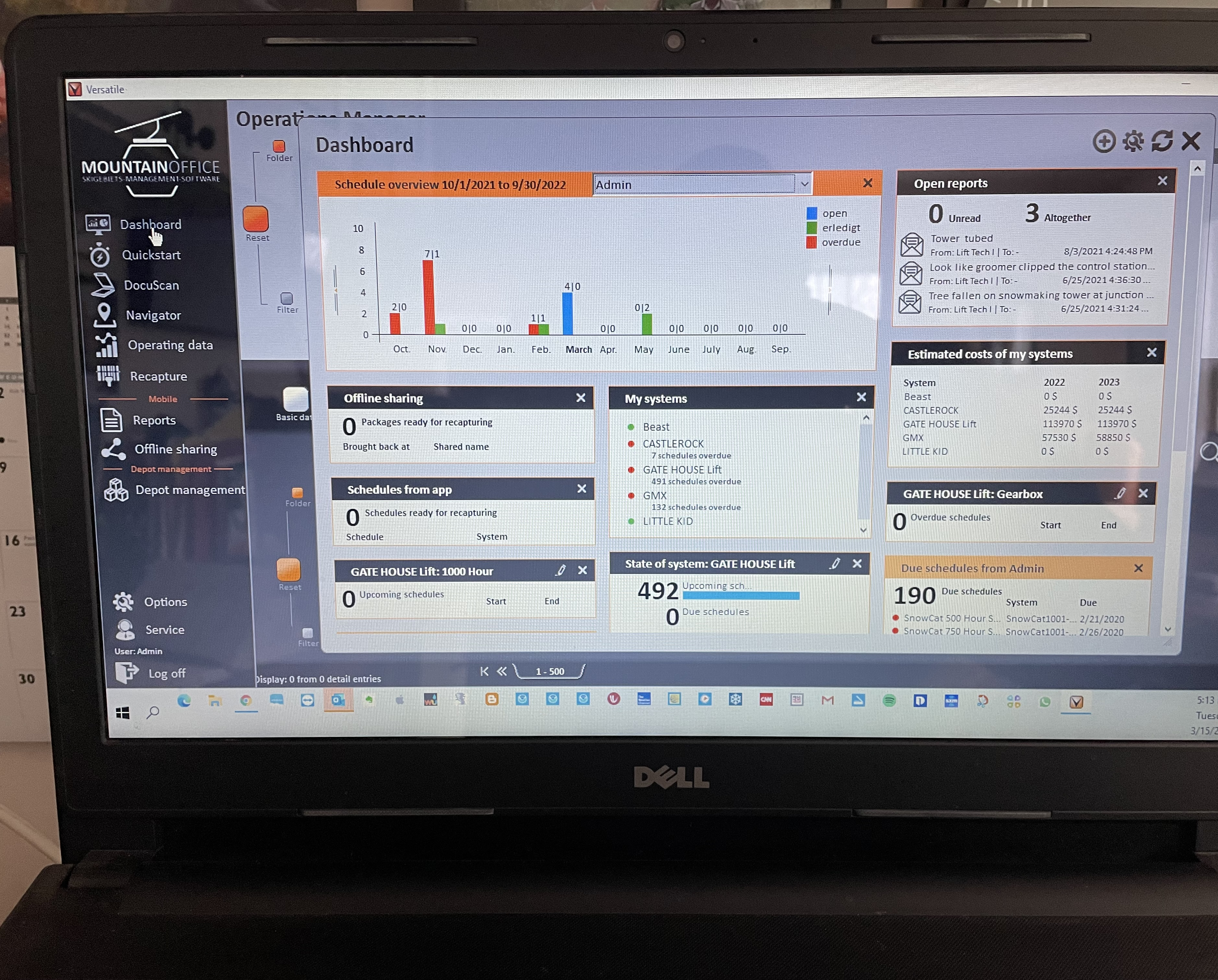
DASHBOARD
Every user has a unique dashboard.
Dashboards can be customized to reflect a user’s specific needs.
Quick access to the status of work and cost .
SCHEDULE/
WORK ORDERS
The schedule function in MountainOffice provides for detailed instructions by task, recording of data such as the temperature of a gearbox, and service bulletins.